Get future-ready with spatial intelligence

How government, infrastructure and commercial organisations are transforming decision‑making, resilience and asset performance using spatial intelligence, GIS and AI. 

Why spatial intelligence is essential for Australia’s critical networks

Australia’s most critical networks are under pressure - from ageing assets, climate risk and population growth, to fragmented systems and rising service expectations.

To stay resilient and responsive, organisations need more than incremental upgrades. They need a smarter, connected way to understand where assets are, how they’re performing, and what’s coming next.

Our latest thought leadership paper explores how spatial intelligence - powered by a Geospatial Information System (GIS), real‑time data and AI - is becoming a strategic foundation for future‑ready networks across Australia.

SectionImage_1
Recolour book
thought leadership

Download your free paper

Get instant access to the Get future-ready with spatial intelligence paper and discover how tailored GIS strategies, expert guidance, and industry best‑practice frameworks can help transform your infrastructure into safe, resilient, AI‑enabled networks of the future. 

What you'll learn

In this paper, you'll explore: 

Tab image 1 resize

The location data gap

Why fragmented, siloed network information is holding organisations back and how closing the gap improves foresight, planning and response.

Tab image 2 resize

What spatial intelligence really means 

How spatial intelligence goes beyond mapping to become a system of spatial record that connects data, systems and teams in real time.
Tab image 3 resize

The role of GIS, AI and digital twins 

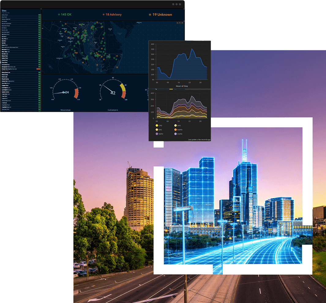
How modern GIS platforms, geospatial AI and digital twins are transforming asset visibility, decision‑making and operational resilience.
Tab image 4 resize

Practical capabilities that drive outcomes 

Including real‑time monitoring, spatial analytics, field mobility, BIM–GIS integration, interoperability and ESG reporting.
Tab image 5 resize

Real Australian examples 

How organisations like The Department of Transport and Planning (Victoria), Energy Queensland, and Fremantle Ports are applying spatial intelligence to improve safety, efficiency and stakeholder engagement.

Who is this paper for?

This paper is relevant for leaders and practitioners across:

Government organisations

  • Cross‑agency coordination and data sharing 
  • Disaster preparedness and response 
  • Public transparency and community engagement 
  • Infrastructure planning and capital works prioritisation 

Infrastructure and utilities

  • Asset lifecycle management 
  • Network resilience and outage readiness 
  • Real‑time operational visibility 
  • Field workforce optimisation 
  • Climate and demand modelling 

Commercial organisations

  • Logistics, mining and large‑scale asset operators 
  • Digital twins and scenario planning 
  • Supply chain and operational visibility 
  • Safety, compliance and ESG reporting 

Whether you’re responsible for strategy, operations, planning, technology or asset performance, this paper provides a clear view of what “future ready” looks like in practice. 

Future-proof your networks with spatial intelligence